The Best Construction Takeoff Software
We’ve evaluated the top construction takeoff software for all project needs, from estimating materials for residential builds to managing takeoffs for commercial jobs. These solutions can help companies of all sizes lower material costs and drive profitability.

- Easy to use and modern interface
- Free version available
- Unlimited takeoffs in paid version
- Efficient communication
- 30-day free trial
- PDF markup tools

- User-friendly interface with low learning curve
- Integration with various file formats, including PDF, DWG, and DXF
- Direct integration with Excel for report creation
Construction takeoff software helps companies automate workflows to make accurate measurements and count items more efficiently. We’ve evaluated systems for all construction companies, including commercial contractors, civil and infrastructure, and specialty trades.
- STACK: Best Overall
- Bluebeam Revu: Best for Civil and Infrastructure
- PlanSwift: Best for Residential Builders
- McCormick: Best for the Trades
- WenDuct and WenPipe: Best for Mechanical and HVAC Takeoffs
- ArcSite: Best for Specialty Contractors
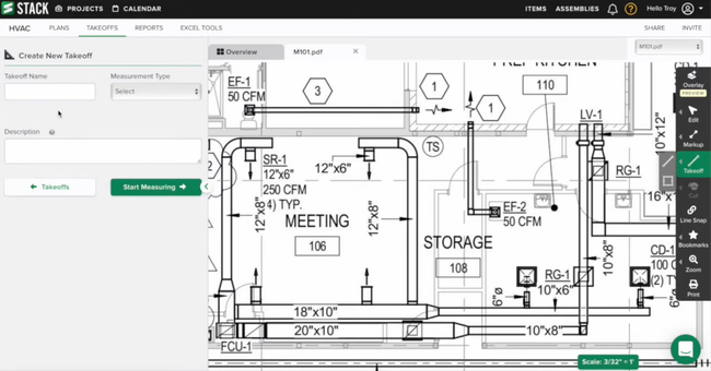
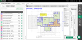
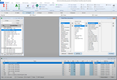
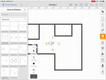
STACK - Best Overall
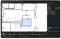
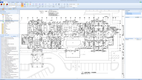
STACK is both a construction takeoff and estimating tool combined into a single platform. Its advanced quantity and material takeoff module generates exact measurements for area, linear, counts, pitched, and volume measurements, significantly reducing measuring time compared to manual paper methods.
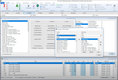
The quantity and material takeoff simplifies material preparation with over 100 pre-built assemblies. These are customizable, allowing you to add your specialized items for a more streamlined workflow. STACK then automatically calculates the material, labor, equipment, and other costs, eliminating the need for manual calculations. This automation helps all trades get their takeoffs and estimates out faster and more accurately.
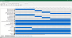
Additionally, the module includes an advanced intelligent plan overlay and revision management tool. It allows estimators to upload and highlight the differences between old and new plans. This enables contractors to make changes quickly and understand what additions, deletions, or modifications have been adjusted. After the revised takeoff is complete, STACK will automatically update the quantities and measurements needed to complete the project.


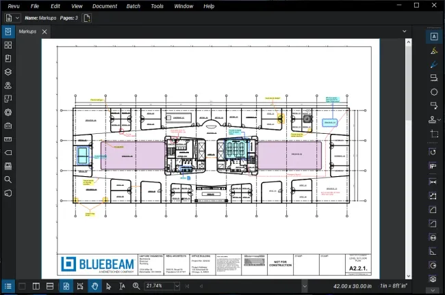
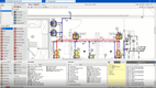
Bluebeam Revu - Best for Civil and Infrastructure
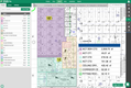
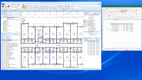
Bluebeam Revu stands out for its ability to handle complex measurements and facilitate collaboration between groups of estimators. Bluebeam allows estimators to perform takeoffs on complex drawings typically found in projects like roads, bridges, or utility installations. It has a dynamic fill tool that lets estimators “paint” over sections to calculate volumes or areas in a second.
It also facilitates multiple team members working on a takeoff from different locations at the same time. It can store all project documentation, revisions, and markups in one place and categorize them according to what works best for your firm. Bluebeam can limit access to specific documents in the software to ensure collaboration is for the right project.
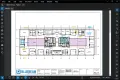
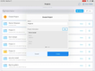
PlanSwift - Best for Residential Builders
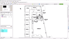
PlanSwift is best for residential estimators looking to improve the time it takes to complete takeoffs. It features a “drag-and-drop” assembly tool that allows users to quickly apply material and labor costs to an area of a blueprint. This feature drastically speeds up the process of takeoffs and reduces the amount of manual entry required to complete an estimate. It also reduces human error, improving the accuracy of residential takeoffs.
PlanSwift is also compatible with Excel, allowing users to analyze, manipulate, and present takeoff data further. For contractors who already use Excel for estimates, this makes the transition just that much easier.
McCormick - Best for the Trades
McCormick Estimating and Digital Takeoff is a software developed specifically for trade contractors. Its standout feature for the trades is its tool for automatic assemblies. This feature allows users to group commonly used items into pre-built assemblies. Electrical contractors can create an assembly for a conduit run, which may include wire, fittings, and labor costs. Plumbers can create assemblies for pipe runs, including elbows, joints, and valves.
Using these pre-built assemblies greatly reduces the time it takes to complete a takeoff and improves the accuracy of estimates. It also allows users to standardize their projects and, once set up, ensure that no item or cost is left out.
While McCormick offers a great system, other trades might find use with another system. We go more in-depth for each trade to ensure you find the right takeoff tool for your construction company below: Trade Specific Tools
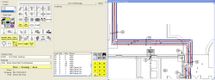
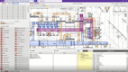
WenDuct and WenPipe - Best for Mechanical and HVAC Takeoffs
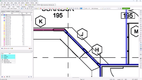
WenDuct and WenPipe are standout solutions tailored specifically for mechanical and HVAC contractors. These tools provide functionality for both digital takeoffs and estimating, with a strong focus on ductwork, piping systems, and mechanical assemblies. Users can quickly perform onscreen takeoffs using scaled PDF plans, and the software will automatically calculate material quantities, labor hours, and costs based on the user’s specifications or the included labor database.
What makes WenDuct and WenPipe best for mechanical contractors is their deep library of industry-standard fittings, hangers, valves, and insulation types. Estimators can build precise assemblies based on real-world installations or standard installations they work on. The built-in labor tables help estimators understand the true costs of labor and completing a job while also ensuring each project will be profitable.
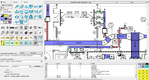
While the WenDuct and WenPipes interface is a bit dated compared to more modern systems like STACK, its comprehensive databases are built specifically for the industry, making it stand out compared to more general takeoff solutions.
ArcSite - Best for Specialty Contractors
ArcSite is best for specialties like flooring, fencing, roofing, concrete, and waterproofing contractors. Its mobile-friendly drawing and markup tool allows estimators to get instant takeoff calculations while in the field. Users can create precise floor plans using tablets or any mobile device without leaving the job site.
ArcSite is unique for its ability to generate takeoff and estimates while the drawings are still being created. While drawing or modifying plans, the software will automatically update and generate takeoff quantities for materials, measurements, and labor. Gone are the days of waiting a day or 2 to provide your customer with an accurate estimate; ArcSite lets specialty contractors respond quickly and accurately to new opportunities.
What is Construction Takeoff Software?
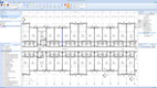
Construction takeoff software uses blueprints and other construction plans to measure, count, and quantify the materials or components for a particular construction project. It will quantify construction materials like lumber, concrete, and steel and measure components like light fixtures, pipes, windows, and cabling.
Traditionally, contractors would have to manually count or measure those materials and perform complex math to determine the area and dimensions of construction drawings. Now, with the help of technology, contractors can take complex drawings and plans and quickly quantify how much material is required for a job.
Each contractor will have varying takeoff needs depending on their industry. A home builder may quantify the amount of lumber, drywall, or installation on a project, while an earthworks estimator would calculate the amount of gravel to fill a hole or the amount of cut and fill to level and grade a job.
Takeoff vs. Estimate
Often, takeoff software is used in conjunction with construction estimating software. However, not all estimating software includes takeoff capabilities. So, what is the difference between construction estimating and takeoff software?
Construction Takeoff:
A construction takeoff, refers to the counts and measures of material and components required to complete a construction project. Often called Quantity Takeoff or Material Takeoff
Construction Estimating:
A construction estimate, is a detailed projection of the costs required to complete a construction project, including all costs for materials, labor, equipment, and other indirect expenses.
If you are more interested in construction estimating software, check out our best construction estimating software page.
So, for a contractor to produce an accurate estimate, an estimator must perform a takeoff to determine the quantity of material and the costs associated with that material.
Not all takeoff solutions include estimating capabilities and only address counting and extracting quantity data from construction blueprints. But many modern products do include estimating and are sold as a 2-for-1 takeoff and estimating solution.

Key Features
Some of the common features of construction takeoff software include:
| Functionality | Description |
|---|---|
| Counts | Count items on digital plans, typically using point-click methods |
| Linear Measurement | Identify and measure linear items on the plans, pulling the lengths of various materials. Items could be wiring, piping, trim, or anything measured in units of length |
| Area Measurement | Identifies and calculates the area and the amount of material needed for enclosed figures. Items could be square footage of windows, drywall, or tiling |
| Volume Measurement | Calculates volumes from project plans; volume is not always visually represented on 2D plans but rather indicated on annotations |
| Predefined Assemblies | Groups a set of of components typically assembled together on a structure. Allows estimators to select the assembly rather than every individual item. For example, light fixtures |
| Plan Overlays | Ability to create layered takeoffs and annotations. Allowing estimators to filter views based on materials to stay more organized |
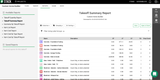
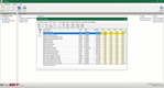
| Material and Quantity Reports | Lists the materials with counts, lengths, and volumes after a completed takeoff. Can be exported to CSV or Excel files or sent directly to an estimating software |
More advanced and less common takeoff features include:
| Auto-count | Uses optical character recognition to automatically count how many times an item is found in a drawing or plan |
| Advanced Volume and Surface Measurements | Indicates variations in the shape of surfaces bound to item volume. Typically used by earthwork or concrete contractors. Most trades may not use this feature |
| Stored and Custom Assemblies | Allows users to define custom assemblies to speed up takeoffs. Typically used when contractors have set assemblies or materials used very often |
| Collaborative Takeoffs and Edits | Syncs edits across takeoff variations, allowing for multiple users to work on the same takeoff at once. Typically found only in cloud-based solutions |
Trade Specific Tools
Many construction takeoff systems have solutions tailored to a specific trade or industry. The functionality of each takeoff tool will vary depending on what features are most used. Check out which takeoff software is best for your industry.
Plumbing Contractors
FastPIPE by FastEST is a takeoff software specifically designed for plumbing contractors. It has tools for automatic fitting generation and includes a plumbing cost database.
Electrical Contractors
For electrical contractors Sage developed eTakeoff. It offers auto-count estimating as well as digital take-off capabilities specific to the electrical industry.
Mechanical and HVAC Contractors
WenDuct and WenPipe provide estimating and takeoff software for the HVAC industry. It has material and labor databases along with automatic pricing updates from major North American suppliers.
Framing Contractors
On-Screen Takeoff handles both estimating and take-off automation. It offers features for auto-counting items and materials and compares construction drawings with an overlay to see differences.
Pricing Guide
Construction takeoff tools are often transparent about their pricing structures. Locally installed systems are typically priced as a one-time fee to download the product. Online or cloud-based tools are sold with a monthly or annual licensing fee to gain access to their tools.
Typically, takeoff software starts at around $80/user/month, while an on-premise takeoff product would start at around $1,000 to purchase the system. Software providers often charge additional fees for technical support or ongoing system updates on perpetual licenses. Systems that include more advanced features or integrate with Construction Estimating and Project Management tools can raise the cost of ownership.